
The Eve
>> Saturday, December 23, 2017
7:00 A.M. Saturday morning update for Christmas Eve. Both the European and short range models show a burst of heavier snow and both have slightly increased totals.

4:00 P.M. Update: This will be the last run of the day unless I decide to stay up late. No big changes. Couple of notes. The temperature should rise once the snow begins so there is certainly a chance to see a mix or even plain rain late Sunday. Points to the south could struggle to get much of anything. With temperatures at or above freezing I don't expect many issues on the roads.
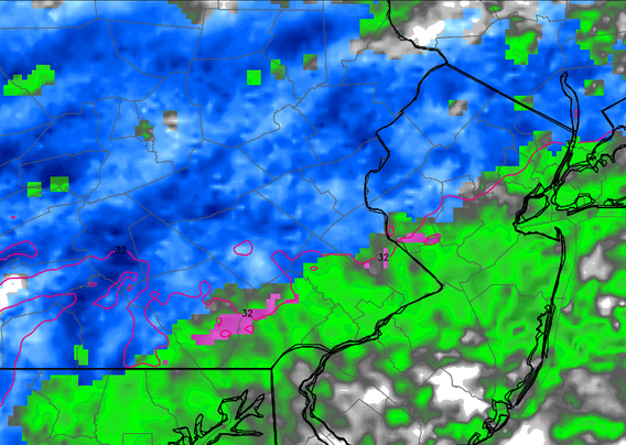
Radar below is for 11:00 tomorrow night. Totals stay similar. Euro model is about the same. GFS pushes the totals a bit further north with our area staying under an inch.


1 comments:
RD-Both this blog and your previous blog were very helpful...concise and easy to understand. Keep updating the Christmas Day forecast, if possible. Good graphics!
DJG
Post a Comment