Winter Weather Advisory

End of Winter

>> Wednesday, February 29, 2012

Hard to have an end when there was never really a beginning.  And I say this while much of the country just experienced a prototypical spring-like storm.  Except it isn't spring.  I guess when our biggest snowfall of the season is in October anything is possible.  I held out for as long as I could but as we now approach March with no signs of cold or snow on the way, I have thrown in the towel and hoping at the least for an abnormally cool summer.

I just got done looking at the long range and it isn't pretty.  Temperatures are primed to move upwards.  Like 60's upwards.  We do have a few chances of soaking rain to break up the monotony of above average temperatures and suns and clouds.  At least when I do my winter in review I can stand tall on my Philadelphia prediction that everybody else blew.  

On a more troubling note it is once again the season to talk tornadoes.  I can't imagine it being anything like last year but with the way the last few days have played out who knows.  It's a bit early to tell what patterns will set up but I wonder what kind of severe weather we are in for.  Tornadoes can occur just about anywhere and we are not in the clear even though nobody talks about it.  As winter fades I will move away from the snowy side and transition back to the stormy and severe.

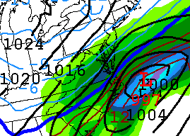
However, I'm not quite done with winter yet even though it might be done with me.  Those flurries in the forecast on Saturday turned into something a little more exciting.  As you can see below a nice band of snow set up briefly from western PA to our area.  It was the closest thing to lake effect snow you could experience this far from a lake.


In fact I went to check the radar after looking out the window and seeing partly sunny skies being overtaken by a line of dark clouds.  Ten minutes later and what a difference.


It got windy.  The snow started to fly, and I was back feeling pretty good again.  Even if it did only last a short time it was what I will assume, a nice little way to end a lackluster winter.  A chance of flurries turned into this lasting image from the 2011-12 season.

  ____________________________________________________________

To cap things off we got a little ugly on Sunday running the trails up and down the pagoda in what could only be described as a technically nightmare for anybody looking for flat ground.  As much as I wanted to enjoy the scenery, I spent 90% of the race looking at the ground.  The uphill climbs kick your ass while you try not to break an ankle on the downhill.  If I wasn't hearing people around me fall, I was passing people limping or being helped.

DETAILS BELOW:


FINISHING SPOT & TIME:


Read more...

Not Looking Good Folks

>> Thursday, February 16, 2012

There is still a lot of time for things to change and if there is a hint of change perhaps we can look at the forecast.  I always look at the models before I take a look at what various meteorologists are predicting.  I only have access to so much information and only so much time to put something together.  All of the national centers have some form of snow in the forecast for Sunday.  But how much, if any is still up in the air.  The models are looking to ruin my fun.

Off we go.


We start with the big boy that had the monster on the map yesterday exactly 24 hours ago.  Not so much of a monster (for us) as it was yesterday.  In this case the low is too far out to sea but West Virginia and Virginia get a nice storm if you know anybody down there.


Here is the Canadian run.  Puts it in a very similar position but without all the moisture to the north.  Not a huge difference from yesterday except it moved a tad south.


This has got to be the worst run for snow for anybody north of North Carolina.  Actually, nobody would get snow in this case.  I think there is a reason you never hear about the Naval model.  Watch it end up begin right... but I don't think so.


And now that we moved closer, we have a new player in town.  This would be the North American run that looks at storms less than 84 hours away.  Looking similar to the others with only Virginia cashing in.  Although this model needs time to zero in.  If I get a chance I will post the updated run in a few hours to see if there is a change.


Remember that GFS 120 hours snowfall map from yesterday?  Notice the shift in predicted accumulating snow now.  We are now in the less than one inch while places to the south and west are closer to 4-6 inches.  Just goes to show everybody went south with the storm.

However, we are still too far away to make an accurate prediction of what will happen.  That's why people monitor this garbage all day.  It constantly changes.  What we need to find is a trend.  If the next runs keep moving the low slightly south or keep it in the same spot, I'm more inclined to say we are onlookers to the snow.  If we can get a bump north, we are back in the game.

I will go against the computers and say it again.  We will get snow this weekend.  Maybe not a storm, but grass covering snow.

_________________________________________________________________

10 P.M. Update

North American model updated a little while ago.  Have to consider this a move in the right direction.  Precip and low both have moved north and there is certainly cold air in the area. 

Check this out.  I also ran a different North American model for our area that shows the precipitation moving in.  This shot is at the furthest point north the area of snow would get.  Basically anything north of Reading would get nothing. 


Read more...

Hype Train

>> Wednesday, February 15, 2012

I tried to pride myself on not jumping to conclusions this winter season since most storms take a long time to develop leaving predictions less than 24 hours away pointless.  Too many times I've seen people dismiss a storm a few days out before we get 6-8 inches.  It happened in October.  And even more times do I see mets talking of the big one a few days in advance only to have the storm steer away from the coast or not even make it up.  I get too excited only to be let down.

Well this season I didn't care what the models said five days in advance.  I wasn't going to put much stock in it.  At least not until everything started coming together.  Only problem was that this season had nothing to get me excited about.  A little snow here, warm temperatures for most of winter, little snow again.  Not a winter to look back at and enjoy.  That is why I am back with the hype.  If the storms miss, who cares.  I've already been less than thrilled with this season anyway.

That's why you will hear it first right here.  We are getting a snowstorm this weekend. 

That's right.  I said it.  I can't take it back now. 


This is what the model shows currently for the weekend.  That is beautiful.  Low right off the coast.  Strong winds from the northeast.  Heavy snow in the interior.  Now I will say this was not even close to what it looked like yesterday at the same time.  But the closer we get to Sunday, the better the chances something happens.  As of now this is looking really nice.  I see the Weather Channel is still sitting on partly cloudy for Sunday.  No surprise there.  They won't even venture a guess until at least Friday.

So where is the problem?  Slam dunk right?  Not quite.  Take a look.


This would be from the Canadian model.  Notice the difference?  Low moves off the coast further south and takes the moisture with it.  We might get a passing flake out of this.


How about this model run from the Navy's prediction center.  Shows that high pressure system dominating the northeast while the low goes out to sea.  Certainly a possibility.


The dreaded euro model.  One of the best advanced models out there.  Bye bye low.  Right in that same area as the Canadian model takes it.

What do we have going for us then?  It's pretty simple.  There should be cold air in place.  I'm even a bit hesitant to say how cold though.  The NAO is projected to go negative right around the 19th.  That could do wonders for the track.  A low is taking a U-shaped track down the Rockies and into the Gulf.  Now will it curve back up?  I say it will.  Or perhaps my will, will will it up the coast.  The models are not really agreeing.

I tried blowing up the GFS total snowfall accumulation predictions for the next 120 hours.  Our area is anywhere from 4-8 inches but less than 30 miles in either direction and you could be looking at 0 or 10.  Plus this is from the same model that has us getting plastered.


Before I go, I have to leave with this regardless of if something or nothing happens this weekend.  A week ago I posted about what was on store for us ahead.  I even posted a picture of what one model showed for right around the 19th or 20th.  You can scroll down the page.  I will wait.  Back yet?  Remember, the picture at the top is the "prediction" of one model for the 19th.  Wouldn't this be something?

Read more...

Last Minute Map

>> Friday, February 10, 2012

Nobody in the area even falls into an advisory.  Shows you something there.  Anywho.

NOAA has two inches for the region.

My favorite rapid refresh model which I always think is very accurate has us around 1.3 inches.  Some of that might be a little guessing of my own.  See map below.


I see the weather channel added snow to the forecast for the 14th.  Believe I had said that first last night so take that.

And I would love to post another picture of that coastal storm except that on the latest run it fizzles off the coast of South Carolina looking nothing even close to what I posted yesterday. 

Read more...

2 For 1

>> Thursday, February 9, 2012

Two chances for measurable snow in the same week?  It cannot be true.  But it is.  After the near blizzard like conditions yesterday that produced anywhere from 1/2 an inch to nearly two inches, we might be on tap to score a little more.

A system that will have to be monitored by people that get paid to will move our way Friday night into Saturday.  Latest track I saw took most of the moisture to our east.  Let me rephrase that.  The heaviest moisture formed to our east.  In a sense it is a very late developing coastal low that kicks back heavy precip into NJ and maybe even Philly, then takes the fun somewhat up 95.  How many times could this change before it happens?  I don't know.  That makes me about as accurate as anybody else.  Looks like places further east and perhaps a bit south have a better chance at a decent snow.

What I am looking forward to is finally a cold weekend.  It is February right?  And look at Sunday.  Highs in the upper 20's with winds at a solid 20-25 mph.  That should make temperatures feel like single digits.  Haven't had a day like that since... have we even had a day like that this season?  A perfect day to throw a log on the fire, do some housework and take in a hockey game or two.  Or you could run in a race with 300-400 other wack-a-doodles like I will be doing Sunday morning in less than thrilling conditions.  I must say I have been complaining about the non-shiverous conditions in the so called "Shiver" race that led me to wear shorts the last two times.  Won't be complaining this time.

For fun (and for the first time in awhile) let's look at the long range. 

I see some light snow in and around the 14th or 15th.  Temps bounce around a bit.

Then right around the 19th or 20th we see this:


If only.  Problem is NAO isn't projected to go negative.  Meaning even if it does turn up the coast which is unlikely, the cold air would not be in place.

___________________________________________________________________

Started this early but waited until tonight to see the latest run of the short term model.  Really pulled back on the enhanced moisture at the coast.  However, we were not getting that anyway.  If anything it looked a little better for us.  I'm calling it now.  Break out the boots, go buy some bread and hunker down.  We are looking at an easy one to two inches. 

Read more...

  © Blogger template Webnolia by Ourblogtemplates.com 2009

Back to TOP